
It was a record hot start to October! Record highs were set in Campo at 105, Palomar Mountain at 93, and Borrego Springs soaring to 112 degrees! Tomorrow will be even hotter as high pressure strengthens over the west.
Temperatures away from the coast will be trending 10 to 20 degrees above average! I'm forecasting record highs tomorrow in Ramona at 104, Alpine at 100, Campo at 104, and Palomar Mountain at 92 degrees, with several more records likely this week.
The Heat Advisory for the inland valleys has been upgraded to an Excessive Heat Warning. At this time it is in effect until 8pm Thursday for highs between 90 and 106 degrees with morning lows only dipping between 65 and 73 degrees for the warmest spots.
An Excessive Heat Warning is also in effect for the deserts until 8pm Thursday for highs between 108 and 115 degrees and morning lows in the mid-70s to low 90s.
A Heat Advisory for the mountains is in effect until 8pm Thursday for highs between 84 to 104 degrees and overnight lows in the upper 60s to mid 70s.
Low clouds and patchy dense fog will be possible each morning, mainly near the coast to 10 to 15 miles inland. Most areas will clear out by mid- to late morning, but stubborn clouds may linger at some beaches into the afternoon. That will keep temperatures more comfortable along the coast, staying in the 70s and a few 80s, and even 60s for areas that see the slowest clearing.
Tomorrow will be the warmest day of this first round of heat, with a minor dip in temperatures by Friday as a storm passes by to the north, weakening the high pressure.
Temperatures look to get even hotter this weekend as another area of high pressure builds. We will likely see the Heat Advisories and Heat Warnings extended or re-issued as temperatures will remain 10 to 20 degrees above average. In fact, Sunday will be the hottest day of the week, with mostly 100s inland and several record highs are likely.
Above-normal temperatures continue into early next week, but they won't be as hot as the weekend. Greater cooling moves in by the end of next week.
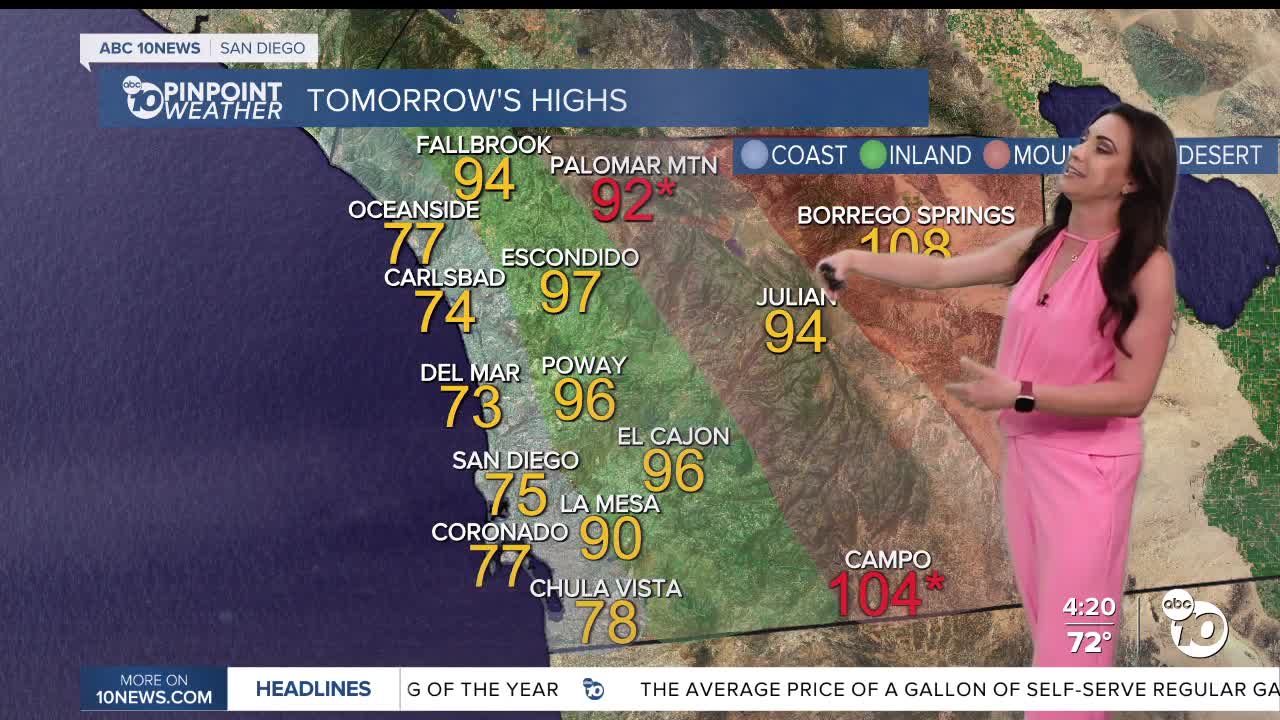
Wednesday's Highs:
Coast: 68-79°
Inland: 90-105°
Mountains: 85-104°
Deserts: 108-111°
Follow ABC 10News Meteorologist Megan Parry on Facebook at Megan Parry 10News, Instagram @mis_meg_wx and Twitter @10NewsParry.
