

It certainly wasn't as hot today with temperatures dropping 4 to 10 degrees from yesterday, but it was humid. Monsoon flow brought anything from a few sprinkles to a pop-up shower today and a lot of stickiness.
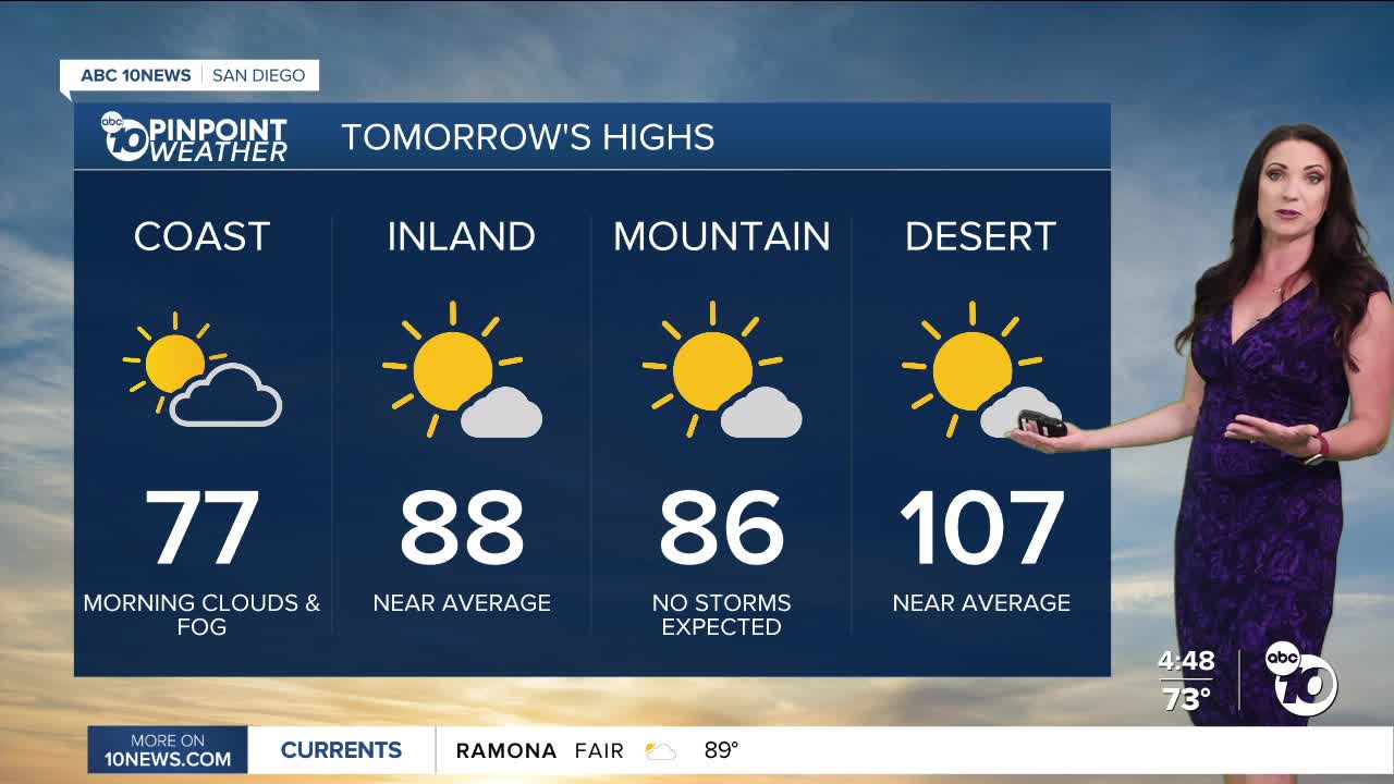
Monsoon flow weakens tomorrow so it won't be as humid and no storms are expected. Friday will be our transition day back into a hotter and more humid weather pattern for the weekend. There is only a slight chance of a stray shower or thunderstorm near the mountains on Friday.
The marine layer will spread farther inland tomorrow, clearing back to the coast by mid to late morning.
High pressure builds this weekend, and monsoon flow strengthens, ushering in hotter and more humid conditions along with isolated showers and thunderstorms. It won't be as hot as last weekend, but daytime highs will run up to 10 degrees above normal.
While peak storm activity will be focused over the mountains it will be possible to see some showers or even a thunderstorm move into the valleys, especially on Saturday. Monday will be our transition day out of the hot and humid pattern with only a slight chance of any monsoon storms.
Any storms that form may produce heavy rain, gusty winds, small hail, lightning, and flash flooding. You should avoid hiking in the mountains this weekend, as conditions will change rapidly where storms form and will catch those outdoors off guard.
A trough of low pressure will usher in much more comfortable conditions starting on Tuesday. The cooler and drier air looks to stick around for a week, giving us a welcome break from the high heat and high humidity.
Thursday's Highs:
Coast: 73-83°
Inland: 85-93°
Mountains: 82-96°
Deserts: 105-109°
Follow ABC 10News Meteorologist Megan Parry on Facebook at Megan Parry 10News, Instagram @mis_meg_wx and Twitter @10NewsParry.
